First Active Western Disturbance of peak winters to bring sct rains in the plains and heavy snowfall over the hills

North India is facing a large rainfall deficit due to the absence of active Western Disturbances while the Himalayas also faced a prolong dry spell which resulted in no snowfall over famous tourist spots and other neighbouring places of northern hills. There has been no rainfall activity in the plains of North India since November and a super long run of dry and foggy winter are maintaining their streak for more than a month. There has been some good news as a fresh active western disturbance with favourable conditions to bring scattered light to moderate rains in the plains and moderate to heavy snowfall at the hills
Weather synopsis
•WD: Active Western Disturbance of magnitude 7/10 is approaching North India and would start to bring some activities from the night of 30th Jan
•CC: A weak cyclonic circulation has been induced over Northern Rajasthan
•Weak Moisture flow from East (Bay of Bengal) and moderate moisture incursion from the Arabian Sea
•Jet Stream: The jet is roaring at above 200km/h and it’s presence has been marked by high level clouds. The Jet core is peaking between 300 to 370km/h and would pass over the subcontinent in next few days, therefore there will be stronger WD during next 2 weeks

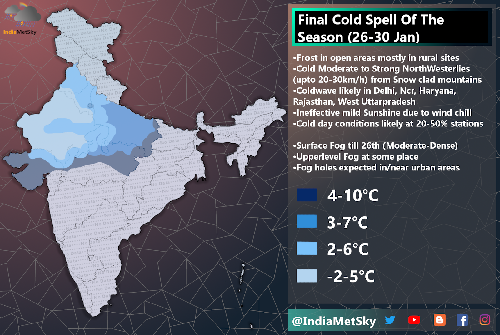
Weather Effects
•The fog will continue to maintain its long streak over the North India and parts of Indo Gangetic Plains during next fews
•Under the effect of this WD, there will be scattered light to moderate rains along with probability of hailstorm near the foothills region and the plains. The light showers will begin from the night of 30th January and will continue till the evening/night of 2nd February.
•Light isolated shower will being from the night of 30th Jan over the Punjab, Chandigarh and nearby areas and the showers will progressively move further into other areas such as Haryana and by the early hours of 31st Jan, many parts of Punjab, Haryana, Jind, Kaithal, Patiala, Chandigarh and adj areas will be receiving light-moderate shower and the later would move into Delhi, Ncr, Churu, Loharu, and other parts of N Rajasthan and W UP and Delhi and ncr. The showers will pick up pace by the forenoon and aforementioned areas would see light to moderate scattered rains with isolated t-storms and hailstorms the spell will manifest itself with feature of gusty winds 25-50km/h and thunderstorms at few places
•The probability of similar weather prevails till evening/night of 2nd February and on/off activities will continue across the plains with peak of this spell is expected to be between afternoon of 31st into evening of 1st Feb.
•Parts of Northern Punjab, Chandigarh, Panchkula, Ambala, Mohali, North Haryana, Kurukshetra will get isolated moderate to heavy rains along with t-storm, lightning strikes and patchy hailstorm on 1st February.
•There will be fog cover over plains and middle and high level clouds will restrict sunlight to reach the surface. So, Cold Day conditions at few places are likely during next 3 days


Comments
Post a Comment