Dry spell to end and a rainy week is coming up for North India
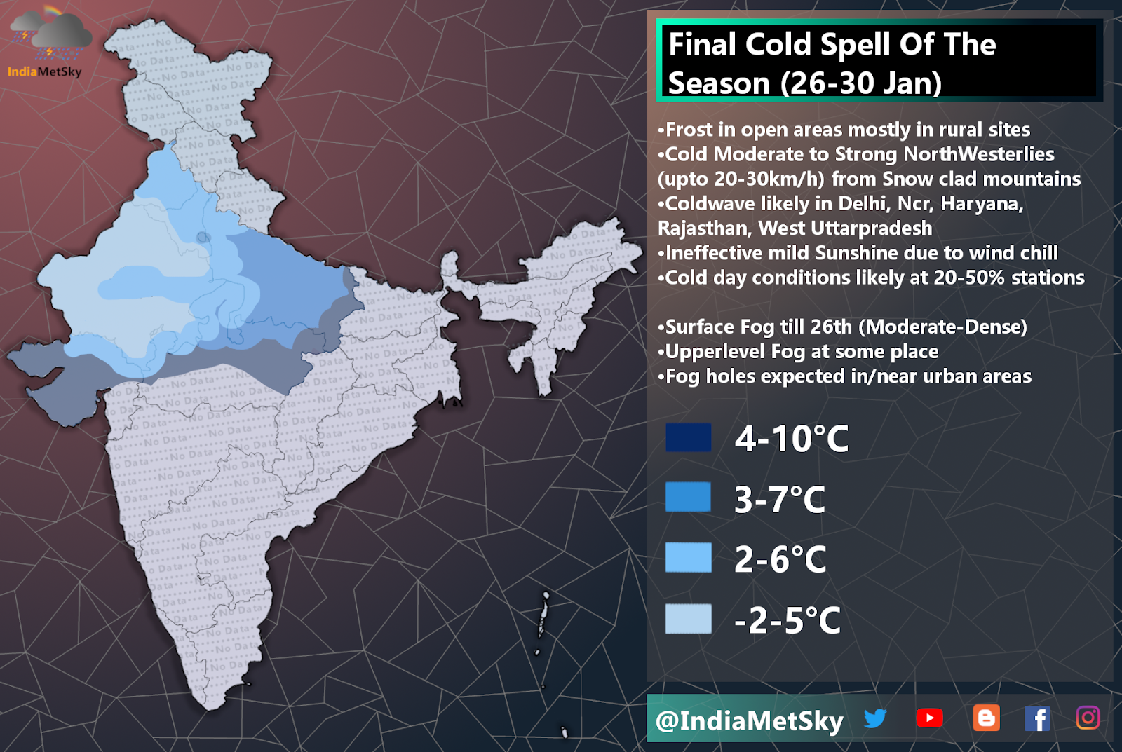
Cold wave abates from North India and adjoining areas atleast for a week after recking cold havoc. Temperature use to fall below 4°C across many places during the night last week and afternoons were comfortable thanks to clear skies but effect of wind chill used to be felt. Now we are moving into January end, the weather pattern is set to change as back to back active western disturbances are expected to affect the north Indian region.
Weather synopsis
•WD-04 or Shamal is a active WD and is graded 9/10 on the intensity scale. The system to start affecting Western Himalayas from late 22nd Jan and it will gradually progress into Hills of Northern India by 23rd Jan.
•A trough extend from the WD into the plains and a weak Low Pressure is embedded into this trough. The low pressure to form over Northern and adj Central Rajasthan. This system to pull moisture from both seas. These are Arabian sea and Bay of Bengal
•Anti Cyclonic circulation or Anti-CC is over Eastern India which will help in guiding the LPA/Trough and the WD system and this Anti-CC to also help in pushing the moisture toward Northern India.
•All these factors combined together to produce alot of instability in the atmosphere and instability in the lower atmosphere to help in development of clouds.
•Peak of this spell will be between 24-26th Jan
•System to exit the region by 27th Jan and there another moderately active WD is expected to soon enter the region.
Weather Effects
•Hills: Widespread to Fairly Widespread snowfall is expected in next 5 day period over Jammu, Kashmir, Ladakh, Himachal Pradesh and Moderate to heavy snowfall is expected in Uttarakhand. Accumulation upto 2-5 feet at higher reaches and 1-3 feet at middle reaches. Snowfall in middle and lower reaches to remain light to moderate with some rains.
🔺22nd Jan: Weather to remain mostly dry with some isolated light-mod snowfall and some rains at some places. Pace of these activities to pickup by night
🔺23rd Jan: Snowfall activity to pick up pace. There will be rise in spread and intensity as well. Activities to become more prominent by evening. Chances for some rains for lower and middle reaches are there
🔺24th Jan: Snowfall activity to become widespread and intensity to increase to moderate with heavy spells and light to mod snowfall for middle and lower reaches. More chances for rains and hailstorm in lower reaches of Jammu, Kashmir, Ladakh and some areas of UttarPradesh
🔺25th Jan: Now the intensity to increase to heavy and activities will be widespread but still scattered with 2-20/50mins breaks in between for some reason. All three regions (Higher, Middle and lower) have great probability of good snowfall and heavy rains or hailstorm at places. Good chances for *20-50%* areas of Himachal Pradesh and Uttarakhand too.
🔺26th Jan: Same as 25th Jan but the spread and intensity to decrease from areas of Jammu and Kashmir while there will be increase over Uttarakhand. Still some areas of Uttarakhand to get light rain or they will remain dry.
🔺27th Jan: Same as 26th Jan
•Plains: Widespread light to moderate rains and patchy thunderstorms are expected in Haryana, Punjab, North and adj areas of Rajasthan, Parts of North MadhyaPradesh, Delhi and Ncr and UttarPradesh. Some isolated places to get moderate to heavy showers with hailstorm. Also wind gusts upto 20-45km/h
🔺22nd Jan: Mostly dry weather for all places apart from very isolated light rains or drizzle in pockets of Aravali, North MadhyaPradesh and Central UttarPradesh.
🔺23rd Jan: Slight rise in overall activities across Delhi, Haryana, Rajasthan and adjoining areas but less chances of rainfall but cloud cover to increase
🔺24th Jan: There will be a increase in overall cloud cover ans isolated light rains will intensify into light to moderate with lightning. Still majority of these acts to remain over UttarPradesh, MadhyaPradesh, Aravalli and Parts of MadhyaPradesh. Activities and cloud cover and rainfall to pickup pace as the day progresses into afternoon/ Late Afternoon. Now, The parts of Delhi and Ncr, Haryana, UttarPradesh, North Rajasthan and adjoining areas of Punjab are expected to observe above mentioned activities and also parts to get heavy spells and hailstorm
🔺25th Jan: Moderate to heavy rains along with lightning strikes and hailstorm is likely in Haryana, Punjab, Chandigarh and adjoining areas of Western UttarPradesh while 50% chances for Delhi and Ncr and other areas. Still Ncr would get typical light to moderate rains or drizzles
🔺26th Jan: Same as 25th Jan but there will be a decrease in cloud cover and rainfall over MP, Delhi and Ncr and adj areas but areas in North like Punjab and Haryana and adjoining areas would get similar activities as they will on 25th Jan. Also few pockets may see some upper/lower level fog.
(No significant Disruption expected in Republic Day celebrations as per current analysis apart from partly cloudy/cloudy skies) A further forecast will be issued 2 days prior to the event!


Comments
Post a Comment