Long dry spell is set to end in North India
North India and other regions of India were witnessing a dull winter and a western disturbance free. The season was going warmer as compared to last several season. There were some factors like negative Arctic oscillation, LA nina year. There was some feeble and super weak WDs.
The long wait for the winter has ended in past 1 week as there was widespread fog blanketing event and significant drop in temperatures and even places recorded cold days too. Two feeble WDs has affected the region in past 12 days and cold northwesterlies strengthened and these icy cold winds dropped the temperature of whole Indo Gangetic Plain region.
The wait for a good Western Disturbance is ending soon and the snowless Himalayas will be covered in snow in next 3 days as a moderate WD is approaching the Western Himalayas. This WD is moderate in intensity and it is rated 7/10 on the intensity scale and it is expected to give good accumulation of snowfall across the Himalayas and som drizzle and cloud cover for the plains
Weather synopsis
•A Moderate Western Disturbance is approaching North India and it’ll affect the region between late 28-early 31st December 2022
•Wind instability over a good extent of Punjab, N Haryana, N Rajasthan & the foothills, hills and some pockets of Delhi
•Its induce Cyclonic circulation (CC) is over North Punjab and it’ll move east, towards the foothills and there it will dissipate. Also a trough is extending from the system towards the SW
Weather forecast
•Activities to start from early of 29th December. Parts of Jammu, Kashmir and adj area to get snowfall and rain mix and some drizzle/light rain or cloud cover is expected in W-N Rajasthan, Punjab and adj areas. Activities to increase as the day progresses and all these acts to move into other areas like Haryana, Ncr, Delhi, other areas of Punjab, Aravalli, and bordering areas of Western UP and tricity by late night of 29th into early 30th December.
•There will be slight rise in both Min and Max temperature across North India. The increase will be of 2-4/5°C due to warm moist winds. The moisture will come with the WD and there will be a moisture feed from the Arabian sea
•Good snowfall is expected in middle and higher reaches of Jammu, Kashmir, Ladakh, Himachal Pradesh and adj areas. Intensity will be moderate to heavy and some pockets to get rainfall mix too. Good accumulation is expected. Lower reaches and some pockets to Uttarakhand to get light snowfall and patchy rain.
•Plains to get cloud cover and some isolated drizzle and light rains. Good chances of Punjab, North Rajasthan, Haryana, Foothills of Punjab, Haryana, Tricity region and some pockets of Aravalli and some small pockets of Delhi and Ncr and Western UttarPradesh. Chances for other places after Punjab and Rajasthan are slim, they might get cloud cover instead
Post WD conditions
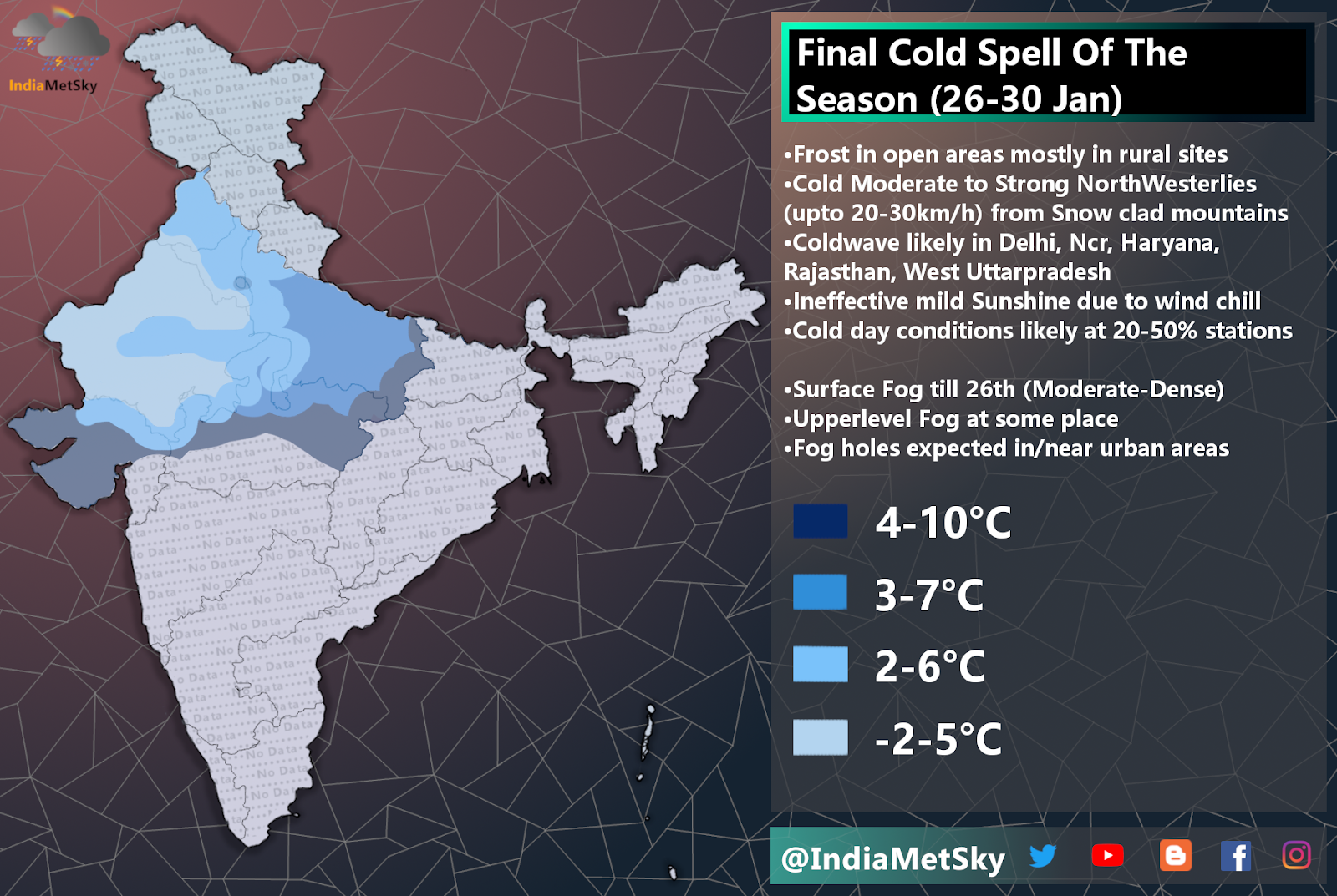
•After the passage of the system, temperature are set to drop significantly over a large region of North, Northwest and some parts of central India. Super cold icy NorthWesterlies to come rushing down. Widespread fog is also expected.
More information will be updated later.


Comments
Post a Comment